Life in the Lava Zone
Hawaiian volcanoes are unique for their size and structure, the largest volcanoes on the planet. Each volcano in the Hawaiian Island chain has a life of its own, each with distinctive chemistry, patterns of activity, and “behavior.” Hawaiian volcanoes are also the most productive in the world, growing rapidly from the seafloor by adding layer upon layer of voluminous fluid lava flows within a very short geologic timeframe. Eruptions occur repeatedly within the caldera region which marks the volcanic center of activity, the “heart” of the volcano, and anywhere along multiple “rift zones” where magma is pumped outward from the center, deep underground. The two most active Hawaiian volcanoes, Kīlauea and Mauna Loa, have produced frequent lava flows in historic times from their summit calderas and from each of their long rift zones.
Welcome to the Lava Zone
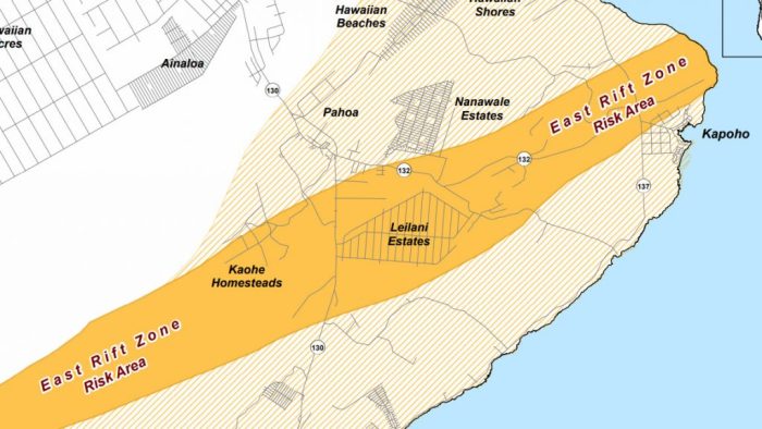
Geologists have divided the map of the island into “Lava Zones” to reflect the risk of eruption and inundation by lava in each area. The lower the number, the greater the Risk in the lava zone. The town of Pāhoa is within Lava Zone 2, a low-laying area at high risk for lava flows due to its close proximity to the East Rift Zone of Kīlauea volcano. Nearby, the popular subdivision of Leilani Estates falls entirely within the mile-wide span of the East Rift Zone, designated Lava Zone 1. Larger swaths of land on the slopes of Kīlauea and Mauna Loa are at risk for lava inundation, designated as Lava Zone 3.
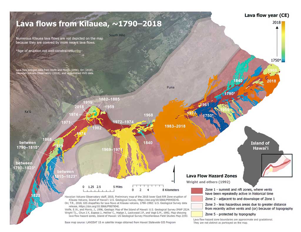
The zones are determined based on multiple factors such as topography, frequency of eruptions at a given location, and the percentage of land area covered in lava over time. Essentially, Lava Zone 1 represents the calderas and active rift zones, where lava can erupt right in your own backyard. Lava Zone 2 represents the areas immediately downslope from the calderas or rifts, where lava can easily flow right into your backyard. Lava Zone 3 includes areas further away from the calderas and rift zones, but sometimes lava can flow long distances, and right into your backyard anyway. Lava Zones with numbers higher than “3” represent areas protected by topography, or areas where volcanic activity is much less consistent, significantly reducing the chances of a lava flow reaching your backyard in this lifetime.
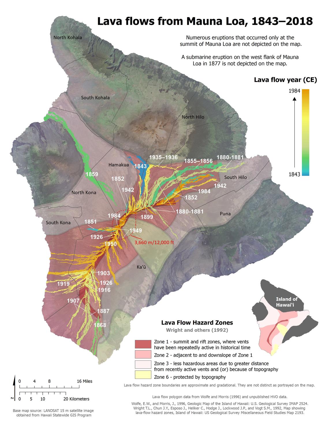

The Lava Zones do a fair job of representing the degree of Risk from lava flows, but too often they are forgotten or dismissed to preserve of the illusion of a changeless paradise. The grim reality of life in the lava zone has a way of popping up when you least expect it, transforming entire landscapes overnight. Island-wide, many communities are at risk including all of Hilo, which could be in the path of Mauna Loa’s next lava flow, and the whole of Puna is geologically guaranteed to be buried in lava from Kīlauea at least once within the next 1000 years!
The most important thing to understand about life in the Lava Zone is that everything here is temporary. Here the risk of volcanic activity is not a question of “If,” but “When?” The Pahoa Lava Zone Museum aims to raise awareness for the constant volcanic threats to communities in Puna and all of Hawaii Island. The beautiful landscapes and easy pace of island life can lure people into comfortable complacency, but within the span of a human life, eruptions can, do, and will occur in the Lava Zone, over and over again.
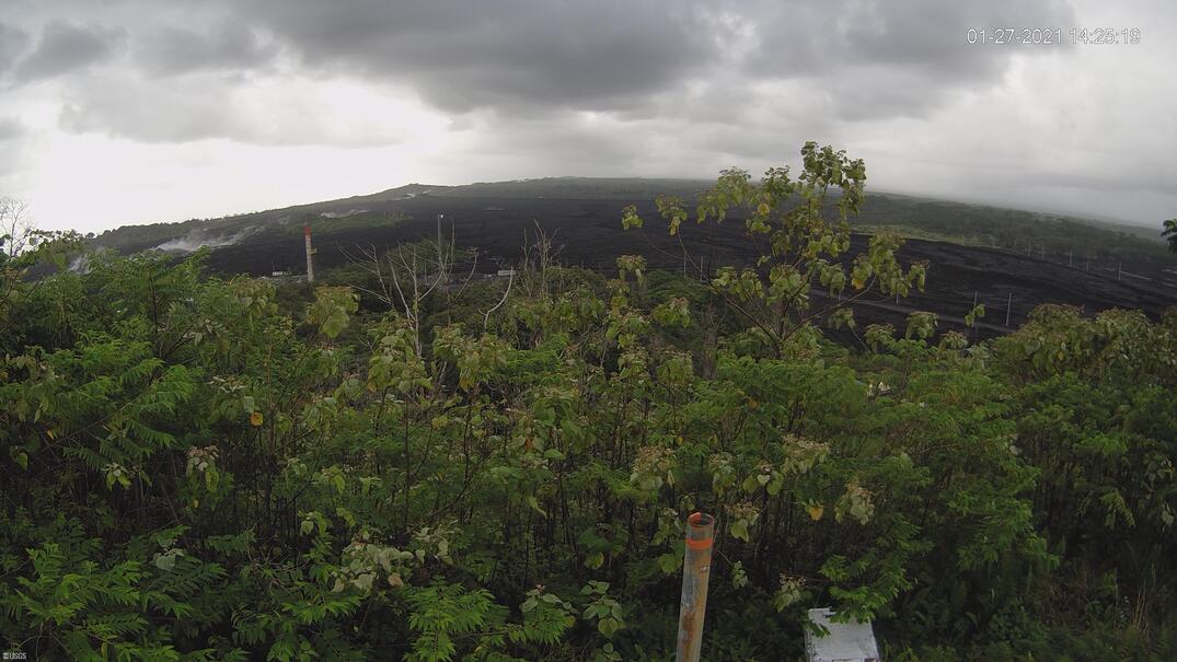
Live Panorama of Fissures in Leilani Estates from Puʻu Honuaʻula [PGcam]
Click image below to view USGS - Hawaiian Volcano Observatory webcam page (opens in new tab/window)
Current Conditions
